Strengthening Climate Resilience and Disaster Risk Reduction
The Maldives National University (MNU) is committed to strengthening national resilience and adaptive capacity to climate-related hazards and natural disasters through research, capacity building, knowledge exchange, and strategic partnerships. Recognising the particular vulnerability of the Maldives as a Small Island Developing State (SIDS), the University contributes to evidence-based climate adaptation by advancing scientific understanding, developing institutional and research capacity, and supporting solutions to environmental and climate-related challenges. Through initiatives such as the RECOVER project and the development of the MNU Environment and Climate Research Framework 2025–2030, MNU seeks to strengthen the knowledge and institutional foundations necessary for building climate-resilient and sustainable island communities. Below are some key research and capacity building initiatives supporting SDG 13.1.
Developing a High-Resolution Wave Forecasting System to Strengthen Coastal Resilience in the Maldives
The Maldives National University (MNU), through its University Research Grant programme 2025, supported the development of the Maldives Experimental Wave Forecast System (MEWFS), an innovative, low-cost ocean wave forecasting system designed to improve understanding of nearshore wave conditions and support coastal resilience and disaster preparedness in the Maldives.
Led by Dr. Shuaib Rasheed, the research developed an automated, high-resolution wave forecasting system for Laamu Atoll. The initiative demonstrates how open-source modelling tools, publicly available oceanographic data, and existing national bathymetric datasets can be combined to develop locally relevant forecasting capabilities without requiring expensive high-performance computing infrastructure.
Development of the Maldives Experimental Wave Forecast System (MEWFS)
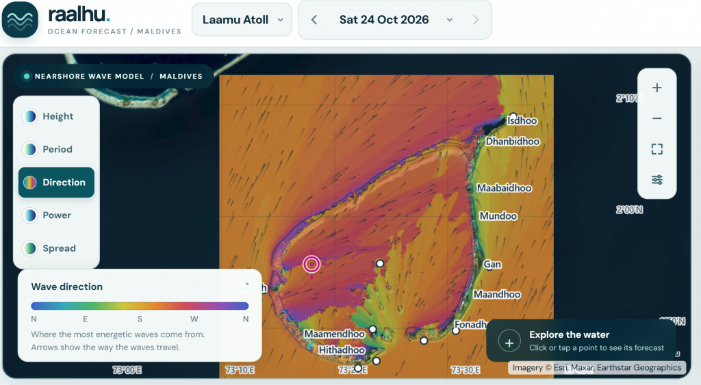
Raalhu portal
The project developed and brought into daily experimental operation a nearshore wave forecasting system using the SWAN (Simulating WAves Nearshore) numerical wave model. The system integrates global wave forecasts from NOAA’s GFS-Wave model with high-resolution bathymetric information to simulate wave conditions across Laamu Atoll, including its outer reef, reef passages, lagoons, and island shorelines.
An automated workflow generates 24 hourly forecasts of significant wave height and mean wave period, with the resulting maps published through a publicly accessible website. The system operates using two low-cost mini-computers, demonstrating the potential for affordable, locally maintained ocean forecasting infrastructure in small island environments.
Understanding Wave Exposure and Coastal Hazards
The research provides insights into the spatial variability of wave conditions across Maldivian atolls. Model simulations indicate that the outer reef systems substantially reduce incoming ocean swell, with wave heights inside the lagoon generally lower than those offshore. The simulations also demonstrate how wave exposure varies around the atoll depending on the direction of incoming ocean waves. These findings are relevant to understanding coastal exposure, identifying potentially hazardous wave conditions, and supporting decisions related to maritime transport, harbour operations, coastal infrastructure, and island-level coastal management. Although the forecasting system is operational on an experimental basis, its predictions have not yet been validated against direct ocean observations. Future integration of wave buoy measurements will be important for evaluating and improving forecast accuracy.
Supporting Climate Adaptation and Disaster Risk Reduction
The project contributes to strengthening the scientific and technical foundations for coastal adaptation and disaster risk reduction in the Maldives. Accessible, high-resolution wave information has the potential to support improved understanding of coastal hazards, inform risk assessments, and assist stakeholders in planning for changing ocean conditions. The modelling framework is designed to be scalable, allowing future expansion to other Maldivian atolls. The project has also made its modelling tools and automated forecasting workflow openly available, supporting further research, technical capacity building, and the development of locally relevant ocean observation and forecasting capabilities.
Through this initiative, MNU contributes to SDG Target 13.1: Strengthen resilience and adaptive capacity to climate-related hazards and natural disasters, by advancing scientific research, developing accessible environmental information systems, and building the technical foundations for evidence-based coastal risk management in the Maldives.
RECOVER – Resilience to Climate Vulnerability and Environmental Risk: Focus on Small Islands
The Maldives National University (MNU) is a partner institution in the RECOVER project, an international research initiative focused on strengthening climate resilience and adaptive capacity in Small Island Developing States (SIDS). Funded through the Climate Adaptation and Resilience (CLARE) programme and led by the University of Waterloo, Canada, the project brings together scientific research, stakeholder engagement, and systems-based approaches to address climate vulnerability and environmental risks.
In the Maldives, the research focuses particularly on water metabolism and water security in Malé, examining challenges associated with resource availability and environmental vulnerability. By generating scientific evidence and promoting collaborative approaches to adaptation, the project contributes to strengthening the capacity of island communities to respond to climate-related challenges and improve long-term resource security.
Project duration: June 2024 – June 2026
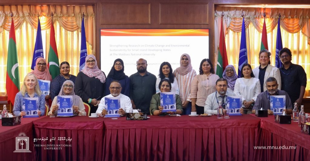
Strengthening Research on Climate Change and Environmental Sustainability for Small Island Developing States (TAP-EDM)
The Maldives National University (MNU), in collaboration with the Ministry of Environment, participated in the initiative Strengthening Research on Climate Change for Small Island Developing States under the Technical Assistance Partnership – Expert Deployment Mechanism (TAP-EDM), implemented by Alinea International. The initiative aimed to strengthen MNU’s institutional capacity to conduct and support research on climate change, adaptation and environmental sustainability, while enhancing its ability to mobilise resources and develop strategic research partnerships.
A key outcome of the initiative was the development of the MNU Climate and Environment Research Framework 2025–2030, informed by consultations with university academics, government stakeholders, and international experts. The framework provides strategic direction for advancing climate and environmental research aligned with national priorities and the challenges faced by the Maldives as a Small Island Developing State. Through improved research planning, institutional capacity building, and partnerships, the initiative supports the development of scientific knowledge and evidence-based approaches that can contribute to climate adaptation, environmental management, and the long-term resilience of Maldivian communities.
Under the thematic category Building Island Resilience to Climate Change, the framework identifies Priority Area 1: Climate-Resilient Disaster Risk Management.
The framework priorities research on:
Climate modelling, forecasting and ocean observations
Climate-resilient infrastructure and land-use planning
Coastal erosion and protection
Community preparedness and early warning systems
Flood risk mapping
This priority focuses on strengthening early warning systems, coastal protection and adaptive responses to climate-related hazards, including sea-level rise, coastal erosion and extreme weather events. It is explicitly aligned with SDGs 9, 11 and 13.
International Research Partnership on Remote Sensing and Climate-Resilient Infrastructure
The AI Foundation Models for Sustainable Asset Management in Emerging Economies: The Benchmark Island Dataset – Pilot Phase project (December 2025 – August 2026) was a collaborative research initiative involving the Maldives National University, Imperial College London, and Google Inc. The project focused on developing a high-quality remote sensing dataset to support the application of artificial intelligence (AI) in monitoring environmental and infrastructure changes in small island environments. The pilot study was undertaken in Kudahuvadhoo, Dhaalu Atoll, where MNU collaborated with researchers from Imperial College London to design and implement a remote sensing data collection strategy. The project involved identifying critical island and offshore locations for monitoring changes in island morphology, coastal environments, and infrastructure over a six-month period. Key activities included two field campaigns involving drone-based surveys, high-precision Ground Control Points (GCPs), and radiometric calibration to generate reliable datasets for testing AI-based change detection algorithms. The project contributed to SDG 13 by strengthening research capacity in remote sensing, geospatial technologies, and AI-based environmental monitoring. The resulting datasets and monitoring approaches were intended to support climate-related risk assessment, coastal change detection, infrastructure vulnerability analysis, and evidence-based adaptation and disaster planning in the Maldives. Through international research collaboration and field-based technical training, the initiative also supported knowledge exchange and capacity building in emerging technologies relevant to climate resilience.
Research Knowledge Exchange on Disaster Risk, Tsunami Hazards and Climate Adaptation (2025)
MNU through its Research Development Office, organised the Lunchtime Talk Series 2025 to promote research knowledge sharing, interdisciplinary learning and research capacity development. The series included presentations addressing climate-related hazards, disaster risk and adaptation challenges facing the Maldives. On 30 September 2025, Dr Shuaib Rasheed, Senior Research Fellow at MNU, presented Nearshore Tsunami Amplitudes across the Maldives Archipelago due to Worst-Case Seismic Scenarios in the Indian Ocean, sharing research on potential tsunami hazards and their implications for disaster risk assessment and preparedness. On 14 October 2025, Ahmed Aslam Waheed, Lecturer at the Faculty of Engineering, Science and Technology, presented Living with Rising Seas, highlighting the challenges associated with sea-level rise and the importance of climate adaptation for vulnerable island communities.
These sessions provided opportunities for researchers and university staff to exchange scientific knowledge and strengthen awareness of disaster risks and climate-related vulnerabilities. The initiative contributes to SDG 13 by promoting climate resilience, disaster risk awareness and research-informed capacity building.
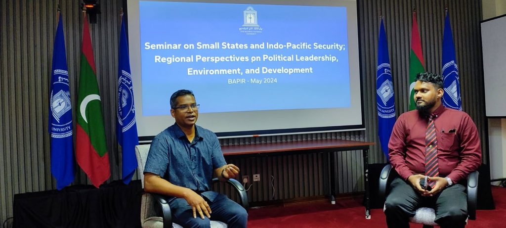
Seminar on Small States and Indo-Pacific Security: Regional Perspectives on Political Leadership, Environment, and Development
The session provided students with an opportunity to examine the political, environmental and development challenges faced by small states within the Indo-Pacific region. Discussions on regional security, political leadership and development strengthened students’ understanding of the complex factors shaping governance and international relations in the region.
Particular attention to the environmental vulnerabilities of small island states helped students understand the importance of climate action, resilience and sustainable development in addressing challenges faced by vulnerable communities. The seminar also highlighted the role of regional cooperation and international partnerships in responding to shared environmental and development concerns.
By connecting academic learning with contemporary regional issues, the seminar contributed to quality education and strengthened students’ analytical understanding of governance, diplomacy and international affairs. Its focus on regional security, cooperation and peaceful approaches to shared challenges further supported the development of informed future leaders committed to strong institutions and sustainable development.
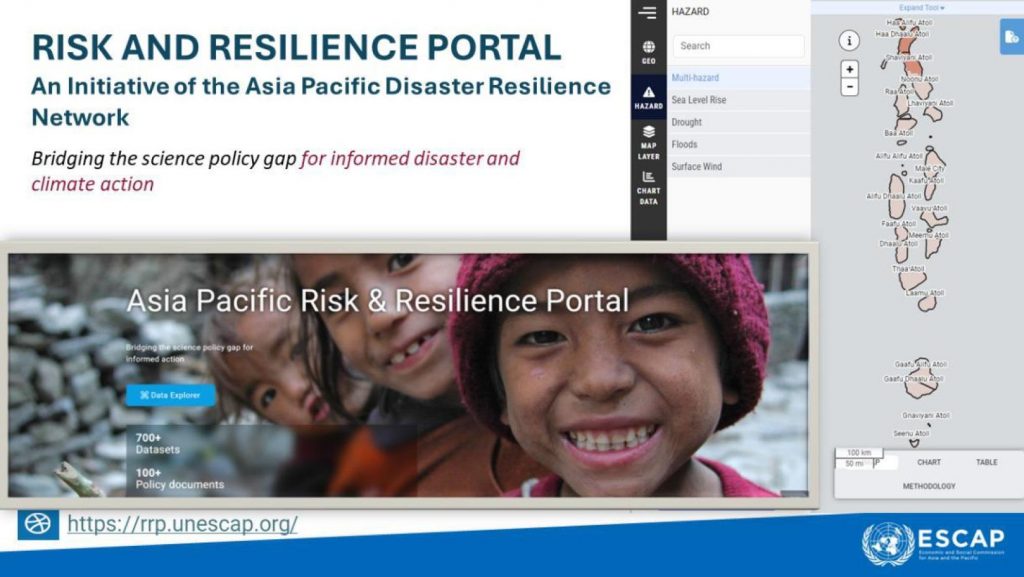
Strengthening Climate and Disaster Resilience through the ESCAP Risk and Resilience Portal
UNESCAP Risk and Resilience Portal
The Maldives National University (MNU), in collaboration with the United Nations Economic and Social Commission for Asia and the Pacific (UNESCAP), contributed to strengthening national and local capacities for disaster risk reduction (DRR) and climate change adaptation (CCA) through workshops, technical training, knowledge exchange, and the application of climate-risk information in development planning.
The collaboration formed part of a broader ESCAP and United Nations Development Programme (UNDP) initiative aimed at integrating disaster risk reduction and climate adaptation into national and subnational planning across the Maldives. Through a series of capacity-building activities conducted during 2023 and 2024, the initiative supported government institutions, local councils, technical professionals, and other stakeholders in understanding climate-related hazards and using scientific information to improve preparedness and resilience.
MNU also facilitates public access to the UN ESCAP Risk and Resilience Portal through its official website, providing students, researchers, policymakers and local communities with access to climate and disaster risk information and decision-support tools. These initiatives contribute by improving access to climate-related information, strengthening awareness and enhancing institutional capacity for climate adaptation and disaster risk management.
Technical Training on GIS and Climate-Risk Assessment
The programme included an introductory online workshop on Geographic Information Systems (GIS) and QGIS on 15 June 2023, followed by advanced technical training in Malé on 14–15 August 2023. Participants were introduced to geospatial analysis, land-use and land-cover mapping, climate models, future climate projections, and methodologies for climate-risk assessment. The hands-on sessions focused on integrating climate-risk information with spatial datasets to support risk-informed land-use and development planning.
Regional Capacity Building for Local Councils and Institutions
Regional capacity-building activities were conducted to strengthen the ability of island-level institutions and communities to identify climate-related vulnerabilities and incorporate disaster-risk information into local planning. Training activities included sessions in Kulhudhuffushi, Haa Dhaalu Atoll, in January 2024, where stakeholders explored the use of the ESCAP Risk and Resilience Portal to support local development decisions. A capacity-building workshop on implementing Island-Level Disaster Management Plans and Vulnerability Assessments was also held at MNU Gan Campus on 28 January 2024, targeting institutions across Laamu Atoll. The workshop focused on accessing and applying data and decision-support tools available through the ESCAP Risk and Resilience Portal. It also facilitated discussions on translating scientific information into practical disaster management strategies and resilience planning. Other non-technical sessions conducted under the wider initiative introduced local councils, policymakers, and community stakeholders to climate change, disaster risk reduction, and the use of web-based decision-support tools.
National and Subnational Planning Workshop at MNU
A three-day (30 January – 1 February 2024) workshop on National and Subnational Planning for Sustainable Disaster Risk Reduction, Climate Change Adaptation, and Mitigation was jointly organised by MNU and UNESCAP in Malé, with hybrid participation. The workshop presented national and subnational climate-risk profiles, geospatial hazard information, exposure assessments, and projected climate risks under SSP2-4.5 and SSP3-7.0 climate scenarios. Participants were familiarised with the ESCAP Risk and Resilience Portal and its applications in assessing climate vulnerability, infrastructure exposure, and disaster risks. The event also provided opportunities for discussions on integrating climate-risk information into policies, disaster preparedness, and national and local development planning.
Strengthening Disaster Risk Reduction and Climate Resilience through the UN4DRR Project
The Maldives National University (MNU) participated in the University Network for Disaster Risk Reduction in the Indian Ocean Rim (UN4DRR), an international capacity-building initiative funded by the European Union’s Erasmus+ Programme. Coordinated by Vrije Universiteit Brussel (VUB), Belgium, the project brought together universities from Europe, the Maldives, Sri Lanka, and Indonesia to strengthen higher education, technical expertise, and institutional capacity in Disaster Risk Reduction and Management (DRRM).
The project aimed to modernise disaster management education through the integration of Geographic Information Systems (GIS), Remote Sensing (RS), and other geospatial technologies into academic programmes, research, and professional training. By strengthening cooperation between universities, government institutions, and disaster management practitioners, the initiative sought to improve the availability of technical expertise and support evidence-based approaches to disaster preparedness, risk assessment, and resilience planning.
Development of the Master of Science in Geospatial Technologies for Disaster Management
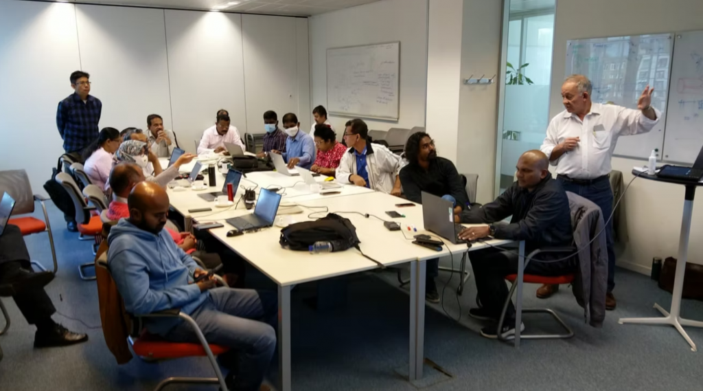
UN4DRR Curriculum Development Workshop
One of the major outcomes of the UN4DRR project at MNU was the development and introduction of the Master of Science in Geospatial Technologies for Disaster Management strengthening postgraduate education and specialised training in disaster risk reduction in the Maldives. The programme integrates disaster risk analysis, Geographic Information Systems, remote sensing, spatial analysis, disaster modelling and simulation, governance, and crisis management. It also includes spatial analysis for climate change and disasters, equipping graduates with technical and analytical competencies to assess vulnerabilities, analyse hazards, and support disaster management and adaptation planning. The programme contributes to developing a national workforce with specialised expertise in geospatial technologies and disaster risk reduction.
Establishment of a State-of-the-Art Geospatial Laboratory
Geospatial lab opening
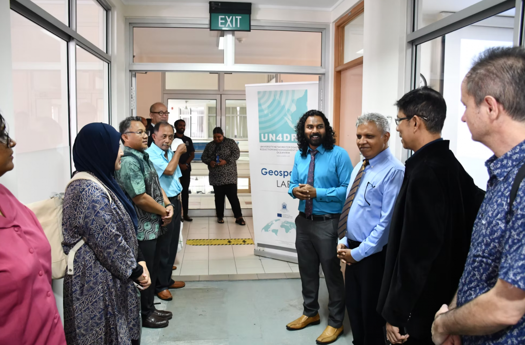
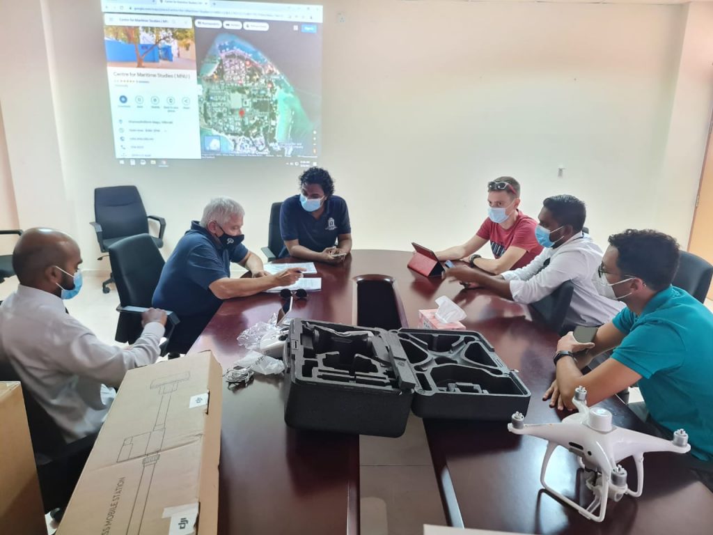
Under the UN4DRR project, MNU established a modern Geospatial Laboratory, officially inaugurated on 29 January 2023. The laboratory was developed with European Union support and equipped with high-performance computers, specialised software, hardware for cartography and spatial modelling, professional drones, and field equipment for geospatial data collection.
The facility supports practical teaching, technical training, spatial analysis, disaster modelling, and applied research. It strengthens MNU’s institutional capacity to provide hands-on education in GIS and remote sensing while supporting the development of technical expertise relevant to assessing environmental hazards and disaster risks.
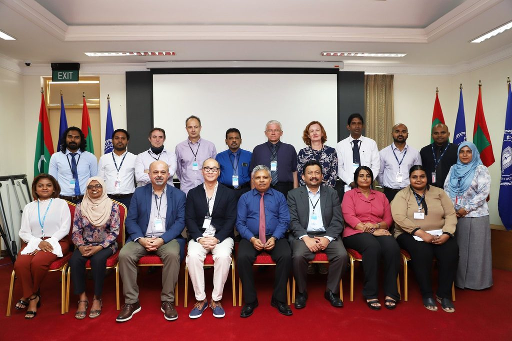
The inauguration coincided with the UN4DRR Technical Training and Partners Meeting held in the Maldives from 29 January to 2 February 2023, bringing together delegates from European and Asian partner universities.
UN4DRR Drone Training
Professional Training and Capacity Building in GIS
As part of the project’s capacity-building activities, MNU’s Faculty of Engineering, Science and Technology (FEST) conducted a practical short course in Geographic Information Systems in 2023. The course brought together 15 participants representing government agencies, non-governmental organisations, academia, and other professional fields. Conducted in the newly established Geospatial Laboratory, the training introduced participants to geospatial data collection, digital mapping, spatial analysis, and modelling using GIS software. The training was designed to strengthen the practical application of geospatial technologies across professional sectors, including their use in disaster risk reduction, environmental assessment, and spatial planning. The wider UN4DRR programme also facilitated international technical training, academic exchanges, and train-the-trainer activities to strengthen teaching methodologies, curriculum development, and the use of GIS and remote sensing for disaster management.
International Symposium on Disaster Risk Reduction and Climate Change
UN4DRR Symposium
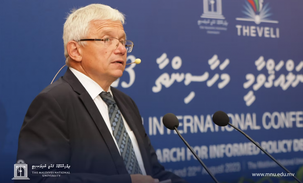
On 22 August 2023, MNU hosted the International Symposium on Disaster Risk Reduction and Climate Change under the UN4DRR project, in conjunction with the Theveli International Conference 2023. The symposium provided a platform for researchers, academics, postgraduate students, and international partners to exchange scientific knowledge and research findings related to disaster risk reduction, climate change, coastal processes, and environmental sustainability. A total of 25 research papers and 13 posters were presented by local and international participants. Students enrolled in the Master of Science in Geospatial Technologies for Disaster Management also presented their research, contributing to knowledge exchange and research capacity development. The symposium was complemented by a pre-conference workshop on Development of Sustainable Cities in the Disaster Threatened World, conducted on 19 August 2023 by Professor Željko Bačić from the University of Zagreb.